Working areas are: observation, quantification, modeling and forecasting
The intention is to jointly gather know-how and develop equipment:
- Improvement of the measuring equipment and measuring methods for sediment transport
- Quantification of the long-term development of the river bed
- Improvement of the model concepts of morphological models for application in the Rhine basin.
Significance of the sediment studies
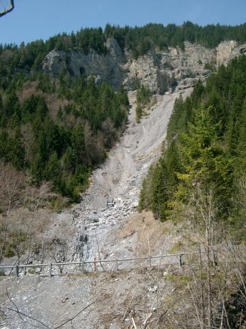
Sediment transport in the Rhine has various consequences. In the past and present day, the riverbed has been subjected to many hydraulic engineering measures and changes which influence the sediment transport and erosion. Sedimentation and erosion can lead to problems in the navigable depth for shipping, to dehydration, to undermining of foundations, as well as to damage to nature and the landscape, for example.
Application of the findings of sediment studies
The study findings provide information which is essential for management of the basin. The sediment project is carried out by three working groups which comprise representatives of leading institutes and who are concerned with the river morphology in the Rhine basin.
- The Measuring methods and measuring equipment working group is responsible for inventory of the equipment deployed in the Rhine area to measure sediment transport, as well as the measuring method used. The most important equipment and methods are mutually compared in joint measuring campaigns.
- The Sediment management and river bed development working group conducts pilot studies into selected stretches of the Rhine, whereby the long-term development of the river bed and sediment measurements are combined to indicate the sediment balance of the stretch in question. This type of study is currently underway for the Dutch/German border area.
- The Morphological models working group applies the model concepts used in the various institutes to carefully defined laboratory and field studies. Comparison of the model concepts allows for identification of their positive and negative characteristics. Recommendations for improvements can then be made.
CHR project 'From the source to the mouth'
The Rhine is one of the most important inland water ways in Europe. The Rhine catchment covers approximately 185.000 km² and is with about 58 million inhabitants densely populated. The Rhine serves many functions, it provides water for industry, agriculture and households but is also a natural habitat and recreation area. Furthermore, due to its favourable discharge characteristics, the Rhine is one of the main navigation ways in Europe. It connects the port of Rotterdam with the industrial areas of the hinterland.
The EU Water Framework Directive incites to consider European river catchments as a whole and therefore transboundary. The Federal Institute of Hydrology (BfG) has established the research and development project "From the Source to the Mouth: A Sediment Balance of the Rhine", to produce for the first time a sediment balance for the Rhine from the source to the mouth. In this project BfG works closely together with the Faculty and Institute for Hydraulic Engineering and Water Management of the Technical University Aachen. The International Commission for the Hydrology of the Rhine basin (CHR) supports the project and has established a project advisory group with members from the Rhine riparian states Switzerland, France, Germany and the Netherlands.
The sediment balance and the existing erosion and sedimentation problems in the Rhine have been studied and described for many years by means of bottom soundings and sediment transport measurements. In addition stone analyses of the Rhine bottom between Iffezheim and the German-Dutch border of more than 40 years are available.
The current studies however do not provide sufficient answers about the origin of the sediment freights in the Rhine, the accommodation of the eroded sediment freights or the connection of morphological processes in the upper and lower reaches of the river. To find an answer to these kind of questions, data must be analyzed in an integral way for the entire Rhine basin. This can only be done with a sound sediment balance. A sediment balance would also enable to pronounce upon the optimization of sediment dumping and dredging strategies, morphological changes caused by climate variability and the calibration of numerical models. The project connects and updates the existing individual studies and improves the data basis through new measuring campaigns.
Aim of the project is a sediment balance of the Rhine from the source in the Swiss Alps to the mouth in the North Sea for the period 1991-2010. A sediment balance describes basically the sediment amounts that enter and leave the research area and the amounts that reside in the area.
CHR publications on the sediment theme
- Kos, Th.J.M. ; Schemmer, H. ; Jakob, A. :Feststoffmeßgeräte und Meßmethoden, Vergleichsmessungen im Rhein, 10-12 März 1998, Report no. I-18
- Dröge, B.; Henoch, H.; Kelber, W.; Mahr, U.; Swanenberg, T.; Thielemann, T.; Thurm, U.(1999): Entwicklung eines Längsprofils des Rheins, Bericht für die Musterstrecke von Rhein-km 800-845. Report no. II-13
- Spreafico, M.; Lehmann, C.; Schemmer, H. Burgdorffer, M. Kos, T.L. (1996): Feststoffbeobachtung im Rhein, Beschreibung der Meßgeräte und Meßmethoden, Report no. II-1